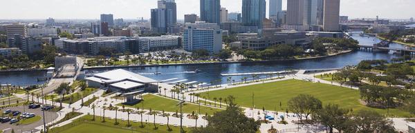
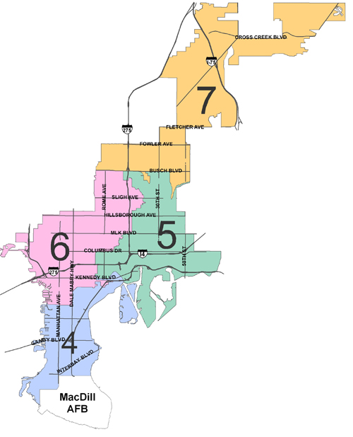
A single member district, running South from San Jose Street to MacDill AFB, including all of Davis Island and Harbour Island.
The district is bordered on the West by Old Tampa Bay, on the South by Tampa Bay, on the East by Hillsborough Bay. The Northern boundary of the district runs West along Swann Avenue from Magnolia Avenue and then meanders North along Boulevard, West along Platt Street, South along Willow Avenue, West along Horatio Street, South along Oregon Avenue, West along De Leon Street, South along Dakota Avenue, West along Swann Avenue, North along Fremont Avenue, West along De Leon Street, North along Melville Avenue, West along Platt Street, South along Armenia Avenue, East along Horatio Street, South along Howard Avenue, West along De Leon Street, South along Armenia Avenue, Southwest along Parkland Blvd., West along Fountain Blvd., North along Audubon Avenue, West along Swann Avenue, Southwest along Henderson Blvd., South along Dale Mabry Highway, West along Palmira Avenue, North along Manhattan Avenue, then West along San Jose Street finishing the district boundary.
Neighborhood Associations in District 4: Ballast Point, Bayshore Beautiful, Bayshore Gardens, Belmar Shore, Port Tampa, Davis Islands, Fair Oaks Manhattan, Golfview, Historic Hyde Park, New Suburb Beautiful, Virginia Park, Palma Ceia, Gandy/Sun Bay South, South Westshore, Portions of Sunset Park and Oscawana.
For More Information on Neighborhood Associations in this District visit the Neighborhood and Community Relations web site or contact them at 813/274-8152
Contact the Council Member for this District